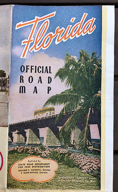
It’s easy to forget what central Florida was like before the “Florida Project” arrived in 1971. You can still catch glimpses of the sleepy towns if you venture a little bit away from I-4 and the other major highways. Initially called the “Orlando Expressway”, that massive project was completed in 1965 and set the stage for Walt Disney World. But what was that area like well before I-4’s construction?
My parents recently discovered a Florida road map from a very different era for the popular tourist destination. Published in November 1947, it shows a state with plenty to offer but with a quieter focus. Destinations like Cypress Gardens, Silver Springs, Marineland, and the Old Fort San Marcos promised a cool mix of history and natural sights. Getting there was a little more challenging, however.
Filled with pictures, this map does more than just show you how to navigate Florida. It also spotlights the vacation opportunities present even 75 years ago. To give some context, we’re eight years before Disneyland opened in California. Just two years after the end of World War II, Americans were ready to enjoy peacetime. Let’s take a closer look at this Florida road map and its exciting locations!
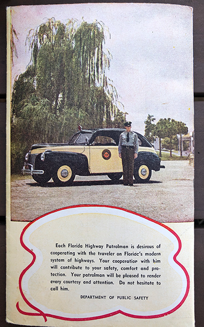
An Important Reminder
Before we begin our journey, we should start with a quick message from the Florida Highway Patrolman. It’s a friendly reminder that even mentions the chance to call him for any needs. He will “render every courtesy and attention” during our trip. Beneath this kind note is a threat about what happens if we don’t cooperate. I’m not sure that I want to get on the bad side of this guy.
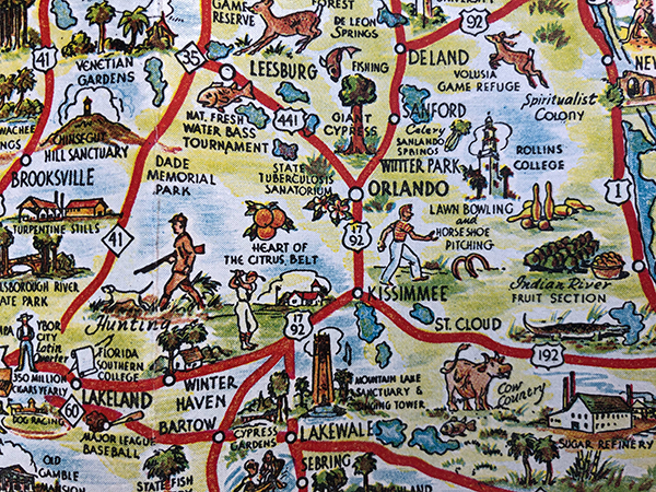
Orlando Before Walt Disney World
Our first stop is Central Florida, which was a bit quieter in the late ’40s. According to the 1950 U.S. Census, the population for all of Orange County was 114,114 (compared to more than three million in 2020). We could enjoy attractions like the State Tuberculosis Sanatorium, the National Fresh Water Bass Tournament, and Cow Country nearby. Fun was everywhere near Orlando!
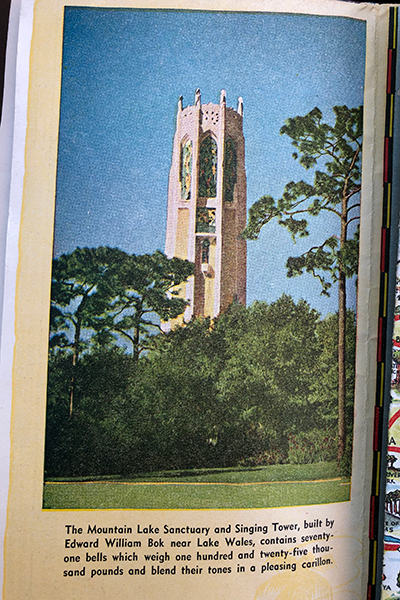
Here’s a closer look at the Mountain Lake Sanctuary and Singing Tower, which remains part of Bok Tower Gardens today. I’ve never visited this site (at least in my memory), but it still draws guests looking for a quieter spot today. The Singing Tower includes a library, bells at the top, and a carillon instrument.
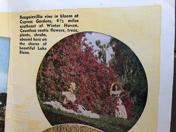
Located near Winter Haven, Cypress Gardens is another classic Florida attraction. It opened in 1936 and charmed visitors with its botanic garden and Lake Eloise. It was known for its water skiing shows even as far back as the time this map originated. It’s a little different today of course. Legoland Florida now occupies this space and charms guests in a different way.
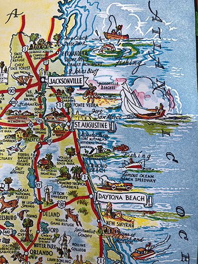
The Eastern Seaboard on the Atlantic
Let’s venture east and check out some of the other fun you can enjoy on the Atlantic coast. There’s the historic city of St. Augustine, Jacksonville, and Daytona Beach. Something that’s missing from the Cocoa Beach area is Cape Canaveral, which wouldn’t come into any use until 1949 before taking off in the late ’50s. I’m not sure it could compete with paper mills and the Fountain of Youth, however.
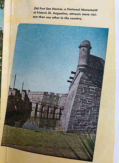
St. Augustine remains a popular destination today for both its history and nearby beaches. This image depicts Old Fort San Marcos, named Castillo de San Marcos today. I don’t believe it attracts more visitors than any other site anymore, but its 17th-century origins remain interesting now.
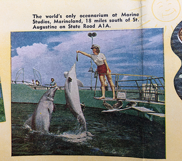
Marine Studios opened in 1938, just nine years before the time of this map. As you can see in this picture, the big draw was the bottlenose dolphins. The name changed to Marineland, and it actually survives today. The current Marineland Dolphin Adventure still entertains visitors 84 years later.
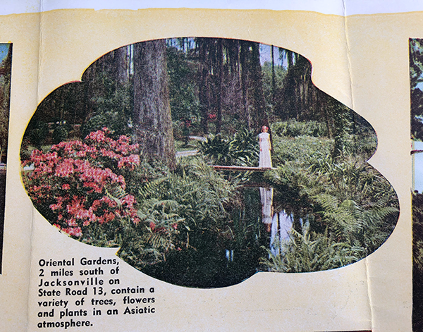
The Oriental Gardens in Jacksonville were just 10 years old at this point after opening in 1937. It didn’t last that much longer and was sold in 1954, unfortunately. Residential homes now occupy this space, which looked stunning at least based on the picture in this map.
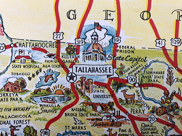
Visiting the State Capital
It’s time to shift to the other side of Florida and visit the state capital of Tallahassee. There are many natural sites to visit, including state parks, gardens, and more. I’ve never been to this area, so it’s always great to learn more about its history.
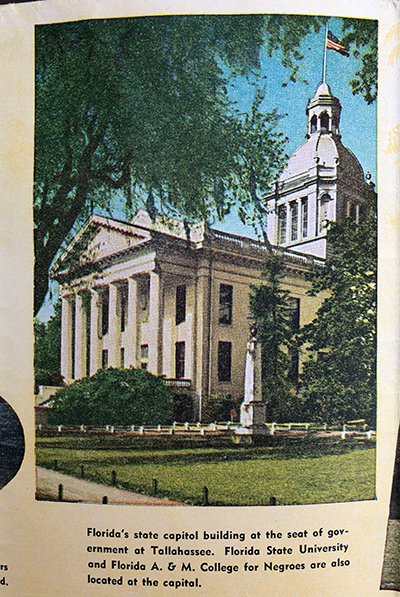
Here’s the official state capitol building, which was not the first one. It started as a log cabin way back in 1824, and this structure opened in 1845. There were several additions, including one in 1947, but it was ultimately replaced by a 22-story office building in 1977. I should note the name listed for Florida A&M, which changed to its current form in 1953. It’s the only surviving public HBCU in the state.
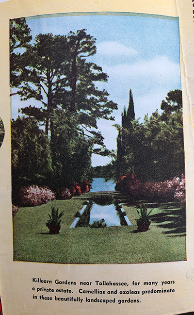
Our next stop is Killearn Gardens, which is now called Alfred B. Maclay Gardens State Park. It’s known for having more than 150 camellia cultivars and 60 varieties of azaleas. These picture does a good job of showing the peaceful garden, which still looks beautiful today.
Stopping in South Beach
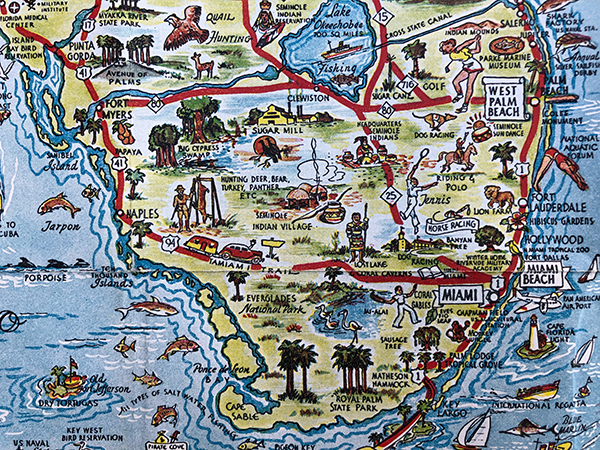
Our final destination is down south at the bottom of the map for more leisure activities. You can see people enjoying golf, tennis, polo, hunting, and more in this picture. The shot of the guy holding up his prey close to Naples might be a bit much for a road map.
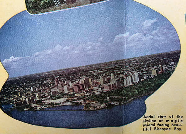
Here’s a cool aerial shot of “magic Miami” near Biscayne Bay, and it seems like a thriving city for 1947. Biscayne Bay is the largest estuary on the coast of southeast Florida and plays an important role for the Port of Miami. I love the way this shot reveals the scope of the city even 75 years ago.
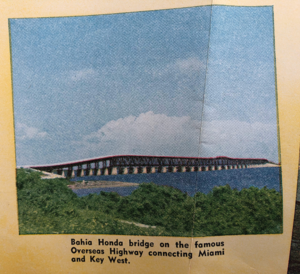
Our final shot reveals the massive Bahia Honda bridge, which started as a railroad bridge until the state purchased it in 1938. Cars no longer use this bridge because a newer version arrived in 1972. This bridge has seen better days and has fallen into disrepair today.
I hope that you’ve enjoyed this trip back to Florida through this 1947 road map! I’d love to hear what you think of this article; leave you comments below!
Related Articles: 1947 Road Map
Seven Takeaways from the Disneyland 1959 Souvenir Guide
Explore the NASA Kennedy Space Center in 1984
Visiting Walt Disney World in 1975
Disney’s Magic Highway, U.S.A.
Checking Out Home Movies of Walt Disney World from the ’70s, ’80s, and ’90s


Leave a Reply